-
- Date:
- Starts from: 10:30 am
Beanley Moor, Beanley Plantation and Titlington Pike occupy an elevated site in rural Northumberland approximately 25 miles north and 35 minutes drive from Morpeth. The summit of the moor, Titlington Pike, is a prominent landmark travelling on the A697 Morpeth to Wooler road.
Entries: It is necessary to enter in advance before midnight on Sunday 12 October. Click here to enter at SiEntries. Entry fees are £12 for seniors or £5 for juniors/students. If you do not have a dibber you will need to hire one, which can be done during the entry process. You will need to pick up your dibber from Download on the day of the event before going to the Start. There will be a charge of £25 for a lost dibber.
Parking / Assembly / Download: Google Maps ///stunning.gains.redefined NU 08424 16724
The event will be signposted from the A697 (Eglingham turn-off)
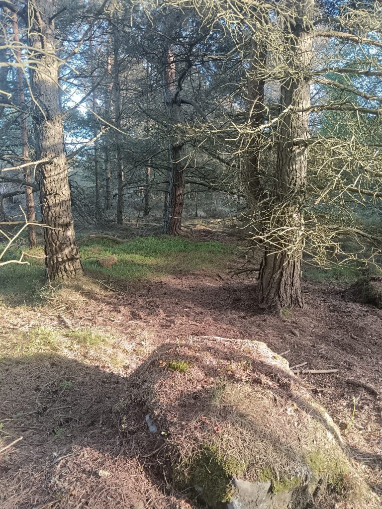
Starts: 1.9km (60m ascent) north-east from the parking/assembly up the minor road and then a short walk on a forest track. The route will be taped. Allow 30-45 minutes walk.
Finish: On the opposite side of the minor road from the parking/assembly.
Course Start Times: 10:30 – 12:30. You can turn up at the start at any time between these times to start. A one minute interval will be left between participants on the same course so you may need to wait before you can start.
Course Close Time: 14:30
Maps: We have a brand new map for 2025 by Paul Taylor. Previous maps are available on RouteGadget here: 2023 event map, 2016 event map
Terrain: White and Yellow courses are on tracks or following fence lines/walls in the forest or on the fellside. Orange/Light Green and Short Green course are in the forest and on the fellside. Green, Blue and Brown courses additionally visit Beanley Moor. The forest has undergone a lot of felling recently but the courses are planned to avoid the worst of the brashings. Beanley Moor has intricate rock and crag detail and some heather to contend with. The fellside towards the finish is fast going. Vegetation hatching on the moor can represent bracken or particularly tough heather. The marshes on Beanley Moor tend to offer better running because they often have animal tracks, and the boundary fence also has animal tracks along most of its length. Thickets across the entire map may be gorse, thick bushes or patches of windblown trees, individual fallen trees are not mapped.
Facilities: A toilet will be available in the parking/assembly field. First aid will be available in the assembly field. The Tankerville Arms in Eglingham serves food and drink from midday.
Safety: All competitors must report to the Download in the assembly field even if you have not finished your course. Full leg cover is compulsory. All competitors must carry a whistle. Cows may be encountered in the fields towards the finish – give them a wide berth. Ticks are present in the area; check yourself as soon as possible after your run. The organiser will advise nearer the time if a waterproof, hat and gloves must be worn or carried (depending on the weather). A risk assessment for the event has been prepared. Orienteering is an adventure sport and participants take part at their own risk and are responsible for their own safety during the event. The event is run under British Orienteering rules.
Strictly no Dogs: Sorry, but no dogs are permitted at this event even if they are left in your vehicle. There have been issues before in the area and we don’t want to jeopardise future events.
Courses
Course Class Map Size / Scale Length Climb White A4 / 1:7,500 2.1 km 40 m Yellow M10
W10A4 / 1:7,500 2.5 km 40 m Orange M12
W12A4 / 1:10,000 3.0 km 55 m Light Green M14
W14A4 / 1:10,000 3.9 km 65 m Short Green M80+
W70+A4 / 1:7,500 3.1 km 50 m Green M75
W60,W65A3 / 1:10,000 4.5 km 70 m Blue M16,M55,M60,
M65,M70
W16,W18,W40,
W45,W50,W55A3 / 1:10,000 6.1 km 115 m Brown M18,M20,M21,
M35,M40,M45,
M50
W20,W21,W35A3 / 1:10,000 7.1 km 160 m North East Championships: To be eligible for the North East Championships competitors must enter the course for their age class.
NATO Club Championships: Runner speed (min/km) multiplied by an age factor multiplied by a course difficulty factor will give a score. Link to NATO Club Championship factors. Entrants can enter any course to be eligible for the NATO Club Championships but may want to consider entering the course for their age class to additionally be competitive in the North East Championships. NATO Club Champions will be declared for men and women in categories Young Junior (12-), Junior (16-), Senior (35-), Veteran (40+), Supervet (55+), Ultravet (65+), Hypervet (75+).
Organiser: Francis Shillitoe, fshillit@hotmail.com, 07941 360 586
Planner: Jonny Malley
Controller: Andy Lewsley – BorderlinersNATO Champion declaration.
NEOA Champion declarations will appear on NEOA websitePlease upload your route to RouteGadget.
Guidance available: “How to upload a route” -
- View the Results